by SUSTANCE | May 27, 2024
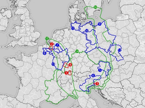
When it comes to organizing and funding public transport in rural, peripheral and especially cross-border areas, there are many challenges and obstacles. We compiled a report where different governance schemes throughout Europe can be found and you can see how they...

by Food4CE | May 27, 2024
On Wednesday 22 May and Thursday 23 May, the FOOD4CE project review meeting was held in Budapest, hosted by the Hungarian partner Hungarian University of Agriculture and Life Sciences – MATE. Two incredible days of in-person work with all project partners to...
by Ready4Heat | May 27, 2024
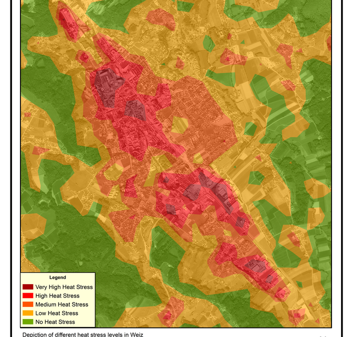
The initial map illustrated varying heat stress levels across the town, highlighting spatial differences in exposure. Forested areas in the west and east showed minimal heat stress, while stress levels increased toward Street 64 due to higher urban density,...
by Ready4Heat | May 27, 2024
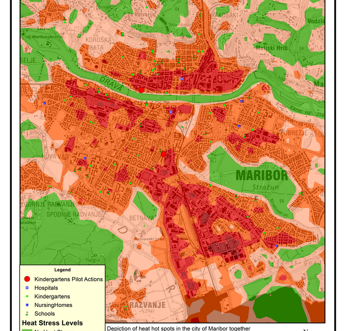
A heat and climate analysis of the city of Maribor was developed as a basis for municipal planning and potential replication in other cities. The map represented the general heat stress conditions across Maribor and illustrated the effects of urban heat...