
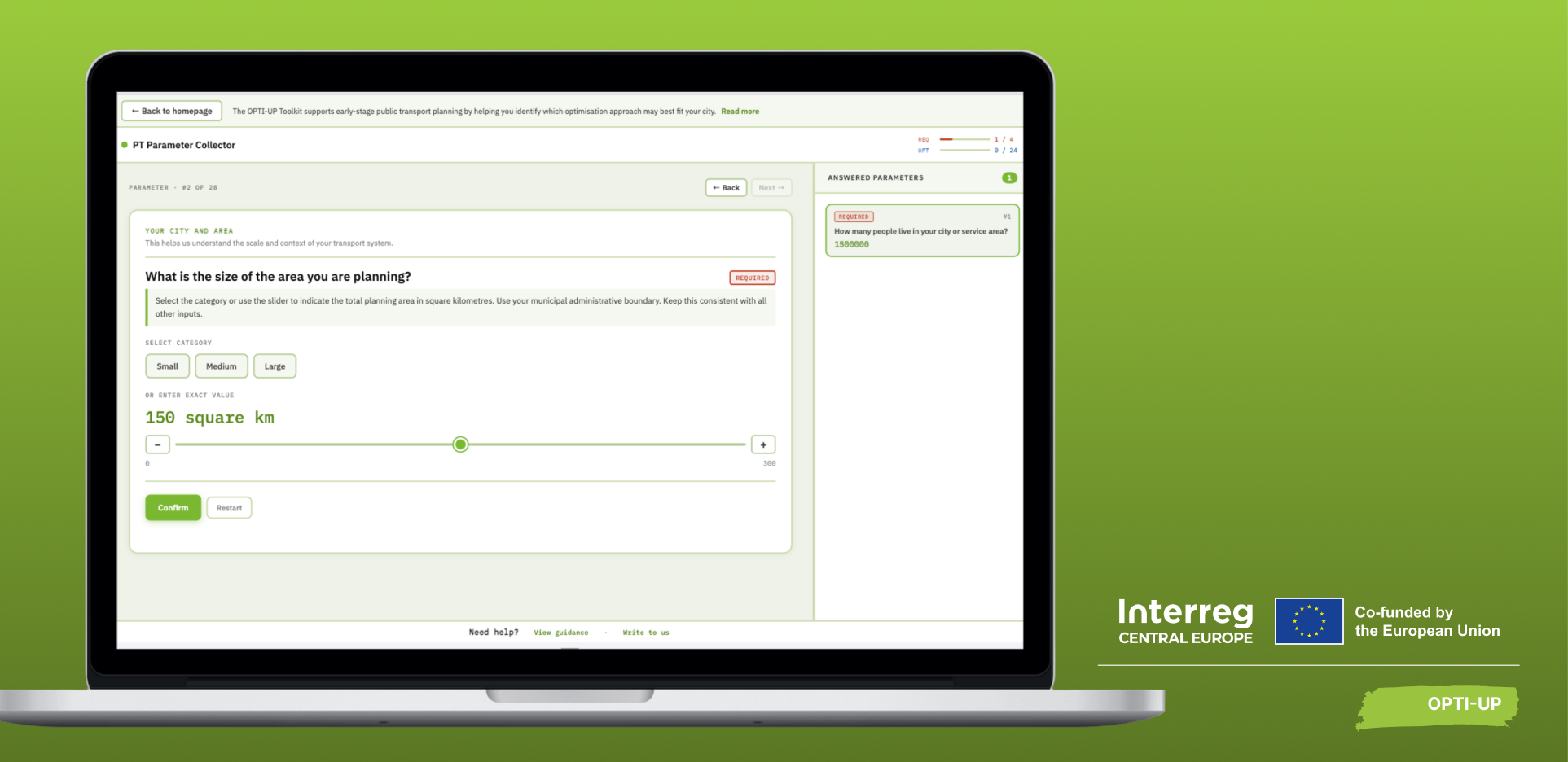
The OPTI-UP Toolkit helps cities explore which public transport improvement strategy may fit their local context. Here is how the process works.
The Toolkit was designed primarily for public authorities, transport planners, regional mobility organisations and other professionals involved in public transport planning.
You do not need to prepare a complete transport study before starting. The Toolkit deliberately combines required and optional information and allows many questions to be answered either with exact values or broader qualitative categories.
The easiest way to understand the process is to try it yourself. Open the OPTI-UP Toolkit and follow the steps below.
Step 1: Describe your city
The process begins with a series of questions about the area you want to assess.
The Toolkit considers 28 variables across five categories:
- Socio-demographics – including population, area, population density and car ownership.
- Public transport supply – including the availability of buses and other modes, transport hubs, service characteristics and stop coverage.
- Public transport demand – including indicators such as perceived vehicle occupancy, public transport mode share and weekday ridership.
- Fleet characteristics – including fleet size, vehicle age and the existing share of electric vehicles.
- Policy goals and time horizon – including priorities such as increasing public transport coverage or ridership, reducing operating costs, improving digitalisation and reducing emissions.
You do not have to answer all 28 questions. Only four variables are mandatory: Population, Area, Population density and Bus availability. These were selected because they are highly relevant to the overall direction of public transport planning while also being relatively easy for municipalities to obtain.
The remaining information helps the Toolkit build a more complete picture of your local context. In general, more relevant input produces a stronger basis for comparison. If you only provide the mandatory information, the Toolkit can still produce a recommendation, but its confidence will reflect the limited amount of information available.
Use exact data where you have it – and qualitative information where you do not. Public transport data are not equally available in every municipality. That is why many questions in the Toolkit do not require an exact figure. If you know the precise value, you can enter it. If not, the Toolkit can accept categories such as low, medium or high for many variables.
This is possible because its recommendation engine uses fuzzy logic rather than rigid thresholds. A city does not suddenly move from one category to another because a single indicator crosses an arbitrary boundary; overlapping categories allow the system to account for intermediate situations.
Step 2: Define what matters to your city
Public transport planning is not only about the current network. It is also about what a city wants to achieve. The Toolkit therefore asks users to consider their priorities.
Depending on the local situation, these could include increasing public transport coverage, increasing ridership, integrating public transport more closely with public space, reducing operating costs, improving digitalisation and efficiency, or reducing emissions.
The selected priorities become part of the city profile used in the recommendation process.
Step 3: Receive a recommended strategic direction
Once enough information has been collected, the Toolkit compares the city profile against its expert knowledge base. Rather than using a simple decision tree, it evaluates similarities with expert-defined cases and ranks the available strategies.
Depending on the inputs, the result can point towards:
- Demand-Responsive Transport – particularly relevant where demand is low, dispersed or difficult to serve efficiently with conventional fixed routes.
- Bus fleet electrification – where fleet transition represents a relevant development direction.
- Public transport network optimisation – where an existing system could benefit from changes to routes, frequencies, timetables or connectivity.
- New public transport implementation – where an area does not currently have an appropriate local service.
The system can also return no recommendation where the available information or strategies do not provide an appropriate match.
Step 4: Explore the experience from the most relevant pilot from the OPTI-UP
The process does not end with a strategy label. For the main strategies tested through OPTI-UP, the Toolkit compares the user’s profile with relevant project pilot cases and identifies a reference solution with similar characteristics.
This gives the user something more tangible to explore: not simply “network optimisation may be appropriate”, but an example of how a related challenge was approached within the OPTI-UP project.
Step 5: Ask questions through the AI assistant
The final phase allows users to explore the recommendation through an integrated AI assistant. Users can ask questions about the proposed approach, relevant OPTI-UP experiences or implementation considerations. The assistant uses a Retrieval-Augmented Generation system, meaning that it retrieves relevant information from connected OPTI-UP documentation before generating its answer.
The AI component is designed to make project knowledge easier to navigate – not to replace the original documentation or professional expertise.
Final Step: Use the result as the beginning of the next planning phase
The Toolkit’s output is an indication, not an implementation plan. Once a promising direction has been identified, the next step is to investigate it in the local context.
That can include collecting more detailed data, consulting stakeholders, conducting feasibility and financial assessments and using appropriate transport modelling to test possible scenarios.
Ready to explore your own city? Open the OPTI-UP Toolkit, enter your local context and see which planning direction it recommends.
Start with your city