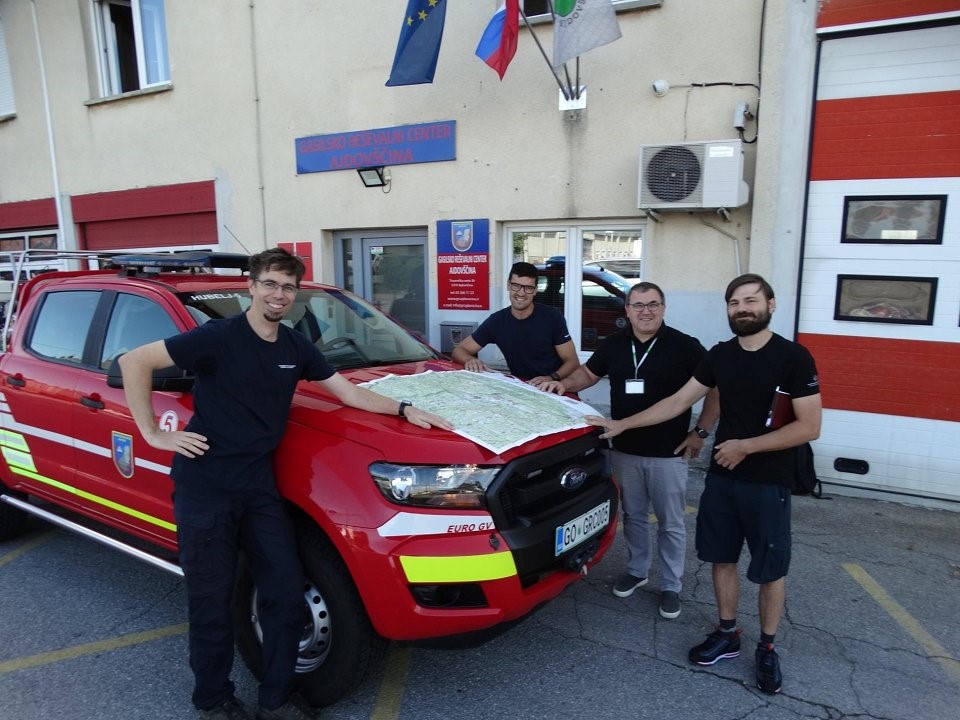
Wildfire management stakeholders from the western part of Slovenia have repeatedly highlighted the need for up-to-date maps for the implementation of preventive and intervention measures to contain wildfires. In Slovenia, both firefighting and civil protection are primarily organised at municipal level. Following these two frameworks, the Slovenian Forestry Institute, in cooperation with the Municipality of Ajdovščina and the Slovenia Forest Service, first produced a map of the Municipality of Ajdovščina, which was soon followed by a map of the area of Koper Municipality.
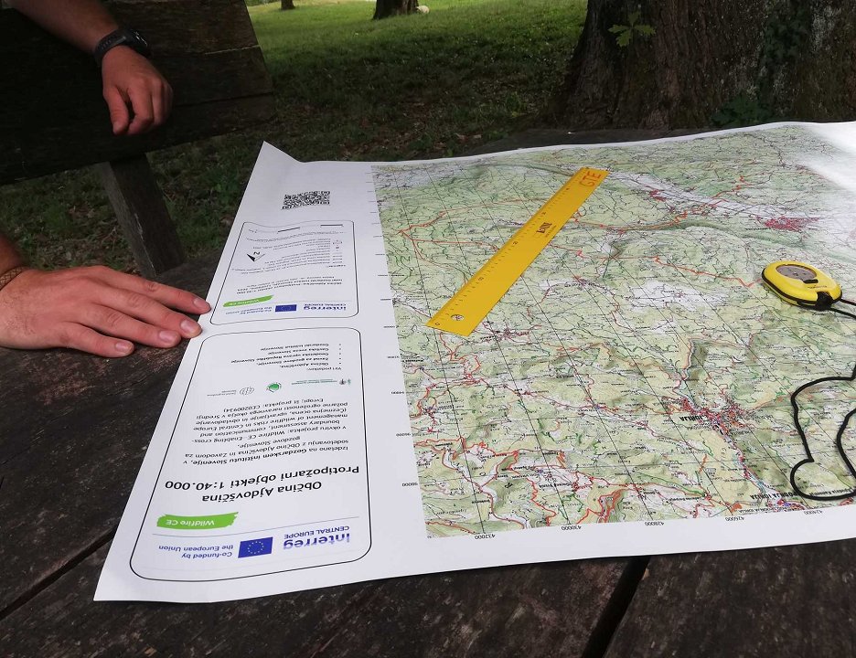
The new maps have the advantage of providing on a single sheet the bigger picture needed for orientation of units in the field, for locating fires in the natural environment, for strategic planning in major interventions, or for coordinating multiple simultaneous events. This kind of larger map format offers an excellent complement to the existing Atlas of Fire Fighting Structures (URSZR, 2009 and GZS, 2021) and represents a new innovative option for providing information on fire fighting structures.
The map is based on the national topographic map (GURS, 2024), to which a number of other up-to-date and relevant data layers have been added. Fire routes are the most important layer of this map, but also the most variable, as the network is regularly updated on the ground, while some routes may no longer provide adequate transport capacity for the intended vehicle category due to administrative constraints and lack of system maintenance funding sources.
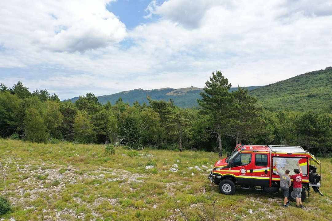
The municipality of Ajdovščina is certainly a shining example of good practice in this area, as in recent years it has been allocating additional funds for the maintenance of fire protection roads in its area, which exceeds the systemic funds for maintenance from the national budget. As a result, practically all fire roads in the municipality of Ajdovščina are transportable by large fire-fighting vehicles.
The municipality of Koper was chosen for a different reason. This is the municipality with the most fire roads in the country, where the numerous railway crossings, the steep Karst edge and the numerous bureaucratic obstacles associated with a fragmented property ownership make the maintenance of the transport network itself, and consequently of the records, significantly more challenging. To this end, the Head of the ZGS KE Kozina, Dane Milošević Štukl, and the GIS representative, Jaša Saražin, have thoroughly updated the records to better reflect the actual situation on the ground with their knowledge of the local situation.
We believe that the maps will make the daily work of the users easier and help to coordinate emergencies. Currently, the maps have been distributed to professional and volunteer firefighting units and civil protection departments from both municipalities, as well as to the responsible local units of the Slovenia Forest Service and the outstations of the Administration for Civil Protection and Disaster Relief of the Republic of Slovenia. By the next fire season, we will prepare a map for more municipalities in the western part of the country.
The map for the Municipality of Ajdovščina is available at this LINK. Keep in mind that:
- the data shown has been verified only for the municipalities of Ajdovščina (and Koper); for the other areas shown, it is for informational purposes only.
- Some of the fire-fighting thoroughfares shown on the map have restricted traffic, allowing only authorized users to drive on them.
dr. Jaša Saražin, Slovenian Forestry Institute, Department of Forest Engineering and Economics Gašper Ogrin, Slovenian Forestry Institute, Department of Forest Engineering and Economics Matej Kravanja, Slovenia Forest Service, Sežana branch Dane Milošević Štukl, Slovenia Forest Service, Sežana branch Matevž Brataševec, Municipality of Ajdovščina